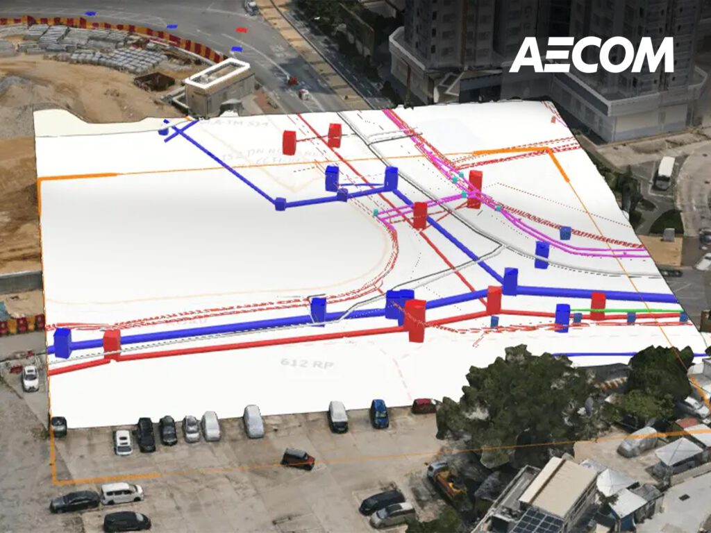
Beneath Hong Kong’s vibrant streets lies a vast and intricate network of underground utilities that deliver essential services — including water, electricity, gas, drainage, sewage and telecommunications — to over 7.5 million people.
Managing and installing these utilities poses a significant challenge due to limited access to accurate and up-to-date location data. To address this, the Lands Department partnered with AECOM to develop the Underground Utilities Information System (UUIS) — a centralized, web-based geospatial platform that collects, validates and shares underground utilities data among key stakeholders.
Leveraging advanced Geographic Information Systems (GIS), digital twins and a dedicated data conversion engine, UUIS enables 3D spatial visualization and standardizes data submission. This helps address issues of data inconsistency, governance, and cybersecurity, while also laying the foundation for Hong Kong’s smart city ambitions.
From an ESG perspective, UUIS delivers measurable benefits. By providing accurate underground location data, it significantly reduces the risk of accidental strikes on critical infrastructure such as electrical lines, gas pipes and water mains during excavation. This not only enhances site safety but also reduces delays, prevents material waste from unnecessary repairs, and lowers environmental impact. Acting as a digital twin of the underground world, UUIS improves project planning and execution efficiency.
The platform also promotes innovation in the industry by integrating advanced surveying technologies, including laser scanning and UAV-based photogrammetric surveys, helping to modernize utility management across the city.
Learn more about how UUIS is a smart solution to map Hong Kong’s hidden depths.